
Multiple storms will move across Iowa on Tuesday, potentially bringing repeated severe weather to the Hawkeye State.
Heavy rain fell across central Iowa early Tuesday morning, with one severe thunderstorm forming by mid-morning. The National Weather Service said the storm is expected to return Tuesday afternoon with the highest risk of severe weather.
Here are the latest updates (Jump to Severe Weather Outlook | Radar | Safety Tips):
11:15 a.m.: When will more severe storms hit Iowa?
The National Weather Service shared a diagram on social media showing the approximate timing of the storm later today.
Thunderstorms could begin in western Iowa around 2 p.m. and move into Des Moines and central Iowa around 4 p.m. Severe weather will move into eastern Iowa at 7 p.m.
11:20 a.m.: Metro schools dismiss early due to fear of bad weather.
At least three Des Moines metro school districts are planning to dismiss classes early Tuesday due to the threat of more severe storms in the afternoon.
- ankeny school: Depart 2 hours early
- Urbandale Community School District: Early dismissal and no half-day kindergarten
- Southeast Polk Community School District: Because children leave school two hours early, there are no night kindergartens or night activities.
- Waukee Community School District: Students will leave work two hours early and after-school activities will be canceled. The district is still awaiting state guidance regarding state playoff events.
11:18 a.m.: Storm dumped about 3 inches of rain across central Iowa.
Des Moines has received just over 1.5 inches of rain since severe weather entered Iowa early Monday morning, and 1.07 inches since midnight.
Some parts of the state have seen nearly 3 inches of rain since last night. Here are the highest rainfall totals as of 11 a.m. Tuesday:
- Harlan: 2.99 inches
- Audubon: 2.95 inches
- Iowa Falls: 2.63 inches
- Waterloo: 2.57 inches
- Decora: 2.15 inches
- Ankeny: 2.02 inches
11:10 a.m.: Thousands without power as storm hits central Iowa
More than 7,000 people in Iowa are without power as a result of Tuesday’s storm.
This includes more than 2,200 MidAmerican Energy customers in Altoona, 2,200 in Des Moines and 1,800 in West Des Moines. According to MidAmerican’s website, power is expected to be restored for these residents from 11:30 a.m. to 3 p.m.
More than 1,000 MidAmerican customers in Council Bluffs also lost power, but that number was recently reduced to about 860. Most of the customers without power were east of Council Bluffs, where MidAmerican crews are on the way to repair the outages.
440 Alliant Energy customers near Dexter were also without power.
9:55 a.m.: Des Moines roads are blocked by storm debris.
At least two roads in Des Moines are closed as severe storms hit the metropolitan area.
The Des Moines Police Department received a small number of reports of downed power lines and damaged trees.
Temporary lane closures are in place in the 3300 block of Grand Avenue and the 3900 block of Urbandale Avenue. According to DMPD, no serious damage or injuries have been reported at this time.
9:28 a.m.: Severe thunderstorm warning extended for eastern Polk County
A severe thunderstorm warning for parts of the Des Moines metro has been extended until 10:30 a.m. Tuesday.
Dallas County was removed from the warning, but it now extends to Jasper County, east to Grinnell and south to Pella.
Threats include 60 mph winds and quarter-sized hail. More than 349,600 people are subject to the extended warning.
9:20 a.m.: Storm dumps large hail in Waukee.
A severe thunderstorm moved through the Des Moines metropolitan area, producing large hail in the western suburbs.
Hail the size of a nickel and a quarter fell in Waukee at 9:07 a.m., according to a trained weather sports expert. Wind gusts up to 55 mph were also reported.
8:42 a.m.: Severe thunderstorm warning issued, sirens sounding in Des Moines.
A severe thunderstorm warning is in effect for much of Dallas and Polk counties until 9:45 a.m. Tuesday.
Shortly after 8:40 a.m., storm sirens began blaring inside the subway. Cities around Des Moines are at risk of winds of up to 110 mph and quarter-sized hail.
The warning covers areas from just north of Ankeny to as far south as Truro. It stretches from Redfield and Winterset in the west to Milo in the east.
Dallas and Polk counties both sound sirens in case of tornadoes or severe thunderstorms exceeding 110 mph. The warning meets that criteria, but Sunday night’s storm caused sirens to go off by mistake.
The siren will not continue to sound during the warning. It will ring for 3-5 minutes, then pause for 10-15 minutes before repeating. There is no sound that completely clears when the warning expires.
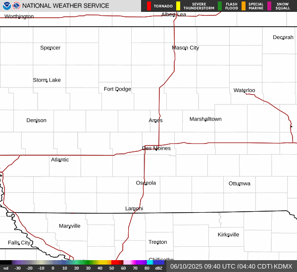
What does Doppler radar show in Des Moines, Iowa?
The current National Weather Service radar loop for central Iowa is:
8:10 a.m.: Severe thunderstorm warning issued for edge of western Des Moines suburbs.
A severe thunderstorm warning is in effect for the Des Moines metro area until 9 a.m. Tuesday.
The warning extends from Dallas Center to Winterset and west to Adel. Possible threats include winds up to 110 mph and quarter-sized hail.
More than 34,000 people live within the warning zone.
7:25 a.m. Storm brings ‘gorilla’ hail to western Iowa
Multiple severe thunderstorm warnings were issued for eastern Nebraska and western Iowa Tuesday morning.
Pottawattamie County, where Council Bluffs is located, was warned of baseball-sized hail until 7:30 a.m.
Banzai The large ones are sometimes called “gorilla hail” because of their size and destructive power.
The National Weather Service has raised the risk of severe weather for much of Iowa. The majority of states rated the risk as “moderate,” or level 4 on a scale of 1 to 5.
more:How much rain has fallen in Des Moines so far? Here are the precipitation totals for Iowa through Monday morning:
Multiple storms are expected to continue into the morning. However, the strongest storms are expected to reach central Iowa between 3pm and 8pm on Tuesday.
Wind damage, hail and flash flooding are the main threats, according to the NWS. Tornadoes (some strong) are also possible.
more:How do tornadoes occur?Describe the severe weather caused by dozens of recent tornadoes in Iowa
Severe thunderstorm warning for Iowa until 1 p.m.
Much of central Iowa, from the southern border to Route 20, is under a severe thunderstorm watch until 1 p.m. Tuesday.
The main threats are hail the size of ping pong balls and wind gusts that can reach 125 mph. Tornadoes are also possible.
What is the difference between a severe weather watch and a severe weather warning?
A watch is issued when conditions are likely to cause severe weather. Often covers a wide area.
Warnings are issued when severe weather actually occurs and Iowans need to take action.
read more:What is the difference between a severe weather watch and a warning?
When a severe weather warning is issued, it’s time to act on your plan.
NWS has tips on what to do in various locations.
- Be prepared for the weather: Please continue to follow local news or listen to NOAA Weather Radio for the latest updates on watches and warnings.
- At your home: If you hear the warning, move to a safe location, such as a basement or bottom floor. If you have time, bring your pet as well.
- At work or school: Please stay away from the window. Avoid going to large open rooms such as cafeterias, gymnasiums, and auditoriums.
- Outside: Immediately go inside a sturdy building. Sheds and storage facilities are not safe. Taking shelter under a tree can be fatal.
- Inside the vehicle: Although being in your car is safer than being outside during inclement weather, if you have enough time, drive to the nearest safe haven. Please do not park under bridges or elevated tracks.
Victoria Reyna Rodriguez is a general assignment reporter at the Register. Contact us at vreynarodriguez@registermedia.com or follow us on Twitter @VictoriaReyna.