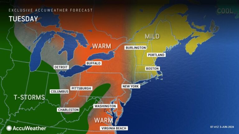
Back-to-back storms are hitting the Midwest and Northeast this week, with a second storm set to bring even more rain and chaos starting mid-week. AccuWeather meteorologists say another shift in weather patterns is on the way after the second storm.
The first storm through Tuesday will still bring clouds, scattered showers and thunderstorms, possibly enough to disrupt outdoor plans and projects across the central and southern Appalachians, the Piedmont and the mid-Atlantic.

By mid-week, a new powerful storm system will move eastward, gathering moisture over the central U.S.
The second storm will dump more rain than the previous one on parts of the Central Appalachians, the Mid-Atlantic and the Southeast, and is much more likely to bring heavy downpours Wednesday into Thursday that could lead to flooding of roads and highways in some cases.
Get the free AccuWeather app
In New York City, the heavy downpours are expected to ease off by late Wednesday night and may not reach Boston until Thursday, but places like Philadelphia could be in the heavy rain zone by Wednesday night, and people in Washington, D.C., may be able to avoid the rain anytime Wednesday. Atlanta will see intermittent thunderstorms through Tuesday afternoon, with more widespread showers and thunderstorms expected Tuesday night into Wednesday.
Get the forecast from AccuWeather

Dry air in New England will not initially bring much rain, but moisture will eventually prevail over the region, bringing scattered thundershowers and rain later this week.
For most of this week, showers and thunderstorms will be unlikely across most of the southeastern United States, including the Florida peninsula.
Severe weather will move east on Wednesday
As the storm moves eastward midweek, it will likely be strong enough to produce locally severe thunderstorms with gusty winds from the eastern Great Lakes into the Ohio and Tennessee valleys and possibly parts of the western slope of the Appalachians.

A new pattern emerges ahead of the weekend
After heavy rainfall from the Appalachians and Piedmont region through the Mid-Atlantic coast and southern and western New England midweek, abnormally cold air will shift southeastward across the Great Lakes and into much of the Northeast later this week and into this weekend.
The influx of air will result in temperatures 5 to 15 degrees cooler than the historical early June average. Highs will be in the 70s to near 80° in the mountains and in the 80s to near 90° along the coast, with highs mainly in the 60s to low 70s in the mountains and in the 70s to near 80° along the coast.

As temperatures drop, clouds will swirl and bring showers and scattered thunderstorms. The showers will be driven by the sun and will occur mostly between midday and early evening.
Want an even higher level of safety without ads? Subscribe to Premium+ in the AccuWeather app for advanced, localized severe weather alerts. AccuWeather Alerts™ are issued by our expert meteorologists who monitor and analyze dangerous weather risks 24/7 to keep you and your family safe.

