Saturday was the hottest day of the year for most of the region, but temperatures will cool off and drop to seasonal averages by mid-week.
SACRAMENTO, Calif. —
Temperatures in the valley soared well above 100 degrees Fahrenheit on Saturday, making it the hottest day so far this year for much of Northern California. Sacramento recorded 105 degrees, beating the previous record of 104 degrees recorded on June 11.
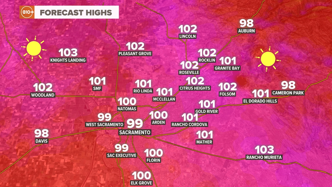
Sunday will be a few degrees cooler than Saturday, but temperatures will still reach triple digits in most of the Valley. Sacramento will be one of the few places in the Valley not to reach 100 degrees, with a high of 99. Delta winds will be stronger tonight and arrive earlier, causing temperatures to drop later in the night.


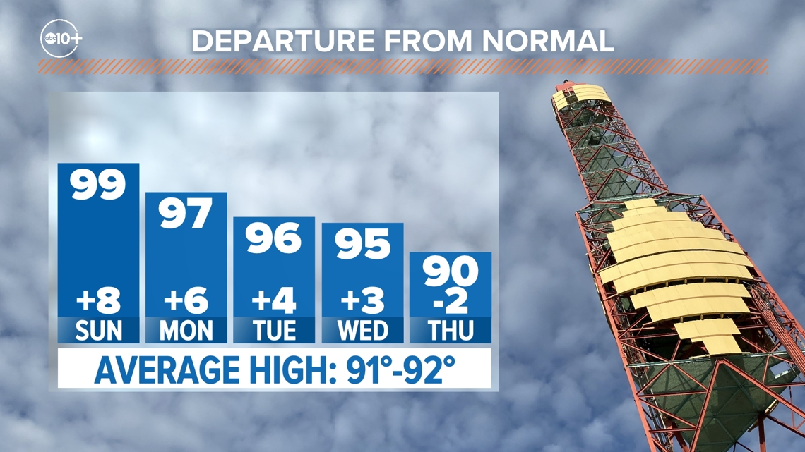
A ridge of high pressure bringing sunny, hot weather is slowly moving eastward, with temperatures expected to moderate day by day through Thursday before a warming trend resumes late next weekend.
Temperatures are expected to drop back down to normal by mid-week, but will still be hot considering it’s late June. The average high temperature in Sacramento for this time of year is 91-92 degrees.


Highs in the foothills and Sierra have been in the 90s to 80s F recently, but will drop to the 80s to 70s F midweek. Thunderstorms are possible in the Sierra on Tuesday, mainly south of Highway 50, as moisture from the remnants of this year’s first tropical storm, Alberto, flows into the region.
Developing cells can produce heavy downpours, small hail, and lightning.
The hot, sunny weather is expected to continue until at least the first week of July.
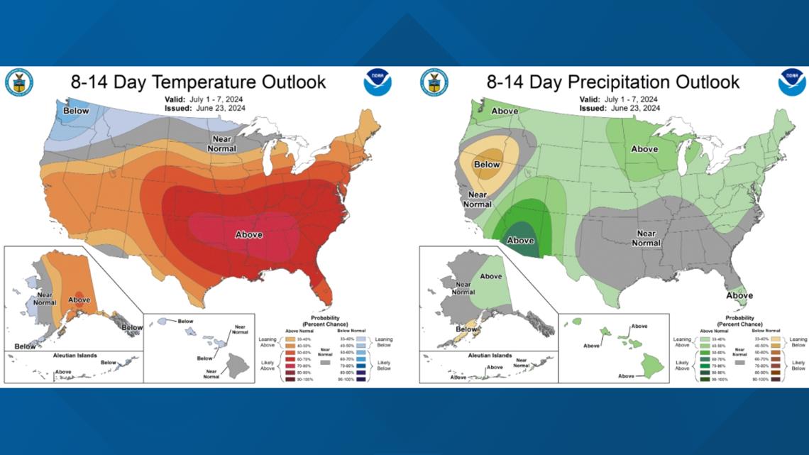
The Climate Prediction Center is predicting dry, hot weather will continue in Northern California for the next two weeks, with signs of a strong Southwest monsoon also notable in the outlook.


Data Collection, Water Tracking, and Climate Change Management in the Delta | Climate Conversations

