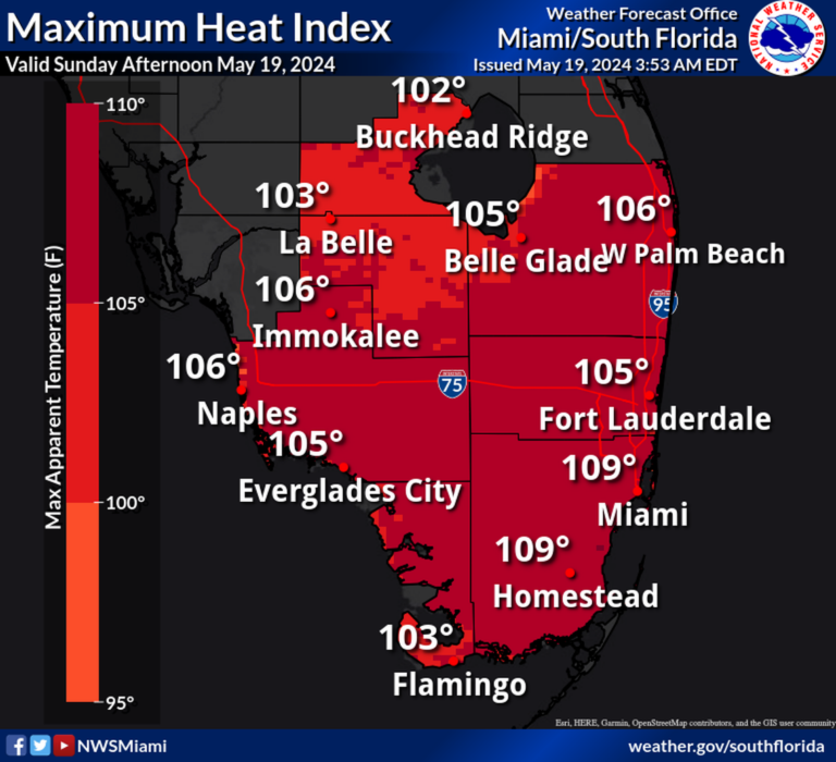
Another day, another extremely hot day.
On Sunday, South Florida once again reached record high temperatures, which the National Weather Service in Miami said have become the norm these days. There was also a severe thunderstorm watch for the area, which ended at 7 p.m., bringing with it intense heat.
Temperatures reached 95 degrees in Miami and Fort Lauderdale, breaking the previous record of 94 degrees. The Miami record has existed since 1995 and the Fort Lauderdale record has existed since 1985. For West Palm Beach, the high temperature reached 98 degrees, breaking the previous record of 94 degrees set in 2008.
“Excessive heat continues today, with maximum temperature indices potentially reaching 110 degrees Fahrenheit in the southern part of the region,” forecasters said in a statement Sunday morning.
good morning!
Severe storms are possible this afternoon, with large hail and wind damage being the main threats.
In addition, the excessive heat continues today, with high temperature indices potentially reaching 110 degrees Fahrenheit in the southern part of the region.#Flwx pic.twitter.com/o558NVB2Vm
— NWS Miami (@NWSMiami) May 19, 2024
According to the NWS, heat index is defined as “the temperature felt by the human body when relative humidity and air temperature are combined.” NWS Miami meteorologists issue a heat advisory whenever the index reaches 105 degrees for at least several hours.
Read more: Weather alert: Heat advisory from Keys to Fort Lauderdale, but tornadoes possible
As we enter May, hot days are gradually becoming the norm. For the first time since May 14, Miami held on overnight and afternoon temperatures matched or broke records for the city. The same was true for Fort Lauderdale, a trend he started on May 7th. The trend began in West Palm Beach on May 13, according to NWS Miami.
Forecasters predicted hail, high winds and lightning across South Florida this weekend, but none of those predictions came true in Miami.

