Powerful storm leaves more than 700,000 customers without power in Texas, more severe weather expected
More than 700,000 power outages were reported in Texas after a series of powerful thunderstorms struck the Dallas-Fort Worth metropolitan area early Tuesday, with more severe weather expected across the region later in the day.
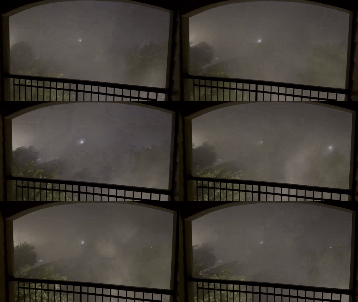
Dallas In Texas, severe weather ravaged the Dallas-Fort Worth metropolitan area on Tuesday morning, causing a surge in power outages, as hurricane-force winds and baseball-sized hail pummeled parts of the area and powerful thunderstorms flipped trailers, snapped trees and ripped roofs off buildings, forcing authorities to sound outdoor warning sirens.
The number of power outages in the Lone Star State soared to more than 760,000 on Tuesday morning as the storm raged through the region, and the National Weather Service issued numerous severe thunderstorm warnings and tornado watches across North Texas.
Dallas County was particularly hard hit, with PowerOutage.us reporting some 400,000 power outages after thunderstorms moved through the region.
There was an error retrieving the Tweet. It may have been deleted.
This latest dangerous weather comes just days after a tornado ripped through the Texas community of Valley View, killing at least seven people, including a child, and injuring more than 100 others.
The tornado was the deadliest to strike Texas since 2015.
Texas storms flip trailers, rip roofs off buildings
Damage from the morning storm was reported across the Dallas-Fort Worth metropolitan area and North Texas, with millions of people bracing for more severe weather expected later in the day.
In Collin County, north of Dallas, emergency responders reported hail the size of baseballs near Raleigh Crossing, and hail the size of ping-pong balls and nickels in several other communities.
WATCH: Video shows severe thunderstorms hitting Carrollton, Texas
Video taken in Carrollton, Texas, shows a powerful thunderstorm moving through the area on Tuesday morning, bringing lightning, heavy rain and damaging wind gusts.
Strong hurricane-force wind gusts were also reported across the region, with gusts of 83 mph reported near Denton and 75 mph at Dallas Love Field Airport.
The extreme weather has caused trees to snap in several areas, including Garland and Dallas.
WATCH: Sirens blare in Dallas as severe thunderstorms hit city
Outdoor warning sirens were sounded in Dallas early Tuesday morning after a series of powerful, severe thunderstorms ripped through the city.
Damage was also reported, with officials saying a building collapsed in the Louisville area. In Addison, storm watchers reported the roof was torn off a commercial building.
There were also reports of a tractor-trailer overturning due to the bad weather, as well as multiple crashes on Interstate 35 in the Louisville area.
Severe thunderstorm warning issued for Texas
Millions of people are under severe thunderstorm watches in parts of Texas as morning thunderstorms move through the region, with more powerful storms expected Tuesday afternoon and into the afternoon.
In Texas, cities including Dallas, Waco, Tyler and Lufkin are under severe thunderstorm watches that will remain in effect until late morning.
The storm will reactivate on Tuesday afternoon.
Texas cities like Houston, Waco, Abilene, Austin and San Antonio are categorized as having a severe weather risk of Level 3 out of 5 on NOAA’s Storm Prediction Center’s five-point severe thunderstorm risk scale, while cities like Dallas, Fort Worth and Corpus Christi are categorized as at a Level 2 out of 5 risk.
The Level 2 threat extends into the east, including Louisiana cities such as Alexandria and Shreveport.
The main threat from severe thunderstorms on Tuesday will be damaging wind gusts and large hail, with some already being reported in parts of Texas on Tuesday morning.
Additionally, tornadoes are possible in parts of Texas.
More than 20 people killed in severe weather over Memorial Day weekend in five states
A threat of rainy weather is expected to continue across Texas throughout the week, with energy from the Pacific Northwest producing showers and thunderstorms that could extend eastern into the Rocky Mountains and High Plains, according to computer forecast models.
Because of dispersed activity, flooding may occur where thunderstorms repeatedly move over the same area.
Widespread rainfall of 2 to 3 inches is expected over the next five days, with some areas expected to get close to 5 inches by the weekend.
No flood watches have been issued due to the extended flooding, but the National Weather Service is expected to issue flood warnings if necessary as thunderstorms could develop across more than 1,400 miles of the country.
While daily precipitation continues, hail and strong winds are expected to be the biggest concern across the Plains, with the possibility of isolated tornadoes not being ruled out.
The continuing threat of wet weather is a reminder that any thunderstorm can produce life-threatening lightning, heavy rain and gusty winds.

